
Company introduction
Shanghai 4U Software Co., Ltd. is a high-tech enterprise focused on government informatization. Its business covers government information systems, adaptation and transformation for domestically controlled IT, data governance and exchange, GIS spatial information systems, and information-system operations. Since its founding, the company has stayed with e-government, serving government departments and public institutions across China. It has built substantial project experience and a record of delivered work, and uses specialized technology and dependable service to help clients improve collaboration, data use, and how their systems run.
The company follows the principles of deep technical work, service first, security and compliance, and continued innovation, and keeps a stable, professional, and efficient technical and service team. Core members each have more than ten years in government informatization. They know government business processes, information-security rules, domestically controlled IT standards, and project management, and can match a client's business needs and existing environment with full-lifecycle services: planning and consulting, solution design, development and implementation, adaptation and migration, and operations.
In delivery, the company joins business needs with the technology that fits them. It offers practical solutions for compatibility and adaptation, data quality, information sharing, and operations. By refining how work is carried out, it helps clients upgrade their systems and improve stability, security, and maintainability, so government business can proceed effectively.
The company maintains quality management, information-security management, project management, and service response as a complete system. Standardized processes run through implementation and day-to-day service, so delivery quality and response stay consistent. Over the years, Shanghai 4U Software Co., Ltd. has become a well-regarded specialist in government informatization in Shanghai. It will keep strengthening its technology and service, and provide lasting, reliable support for clients' digital transformation and government informatization.
What we do
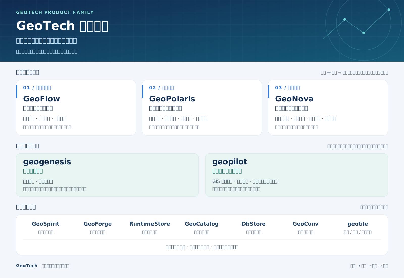
GeoFlowVisual spatial analysis modeling
GeoFlow turns a spatial analysis idea into a visual workflow. Users arrange operators on a canvas, connect data, set parameters, and check the model with workflow validation, so complex steps are easier to understand and adjust, and the model has a clear starting point for delivery and later runs.
GeoPolarisAnalysis models and task management
GeoPolaris manages spatial analysis models in one place, with model assets, versions, publishing, and task scheduling. It connects model building, analysis execution, and business systems, so a workflow becomes a managed, reusable, and callable business capability.
GeoNovaSpatial analysis execution engine
GeoNova runs analysis workflows in a distributed way. It schedules compute tasks, tracks run status, retries failures, and recovers runs. It turns an analysis model into real compute work and keeps complex spatial workflows running steadily.
geogenesisSpatial data production
geogenesis processes and standardizes spatial data, turning raw data into resources that later systems can manage and use. It sits between data acquisition and data consumption, and prepares a standard base for analysis modeling, data management, and service publishing.
geopilotSpatial data management and service publishing
geopilot brings spatial data management, data preview, and map and data service publishing together, so users can organize and use GIS resources. By publishing data as services that business systems can call, it connects spatial data with business applications and supports sharing and operational use.